
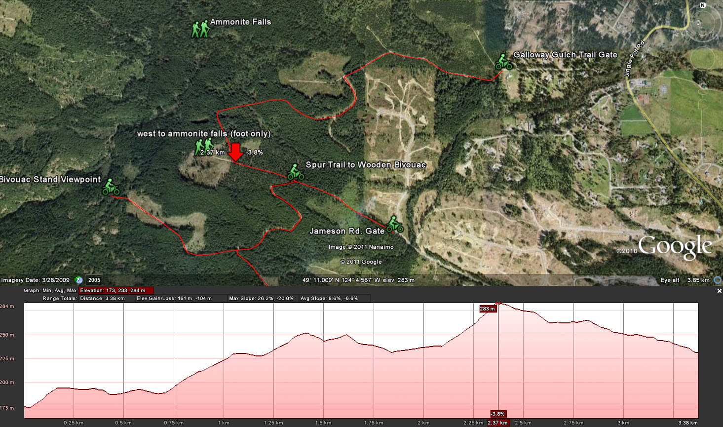
I took my GPS out today and marked waypoints along the trail so I could show a more accurate path on Google Earth. Google has some really great features: If you right click a saved path in the lower left pane, it allows you to display an "elevation profile." I thought I'd post some pictures of the trails with elevations shown today. These images show up full size when you click them. The large red arrows on the elevation pictures are showing the high point for that particular trail.
 |
| Galloway Gulch Rd. to Jameson Rd. with both Spur Trails Shown |
 |
| Galloway Gulch Rd. to Jameson Rd. Trail with Elevation Profile |
 |
| Spur Trail from Main Trail to Wooden Bivouac with Elevation Profile |
 |
Spur Trail Off the Bivouac Trail Leading to Big Rock Viewpoint with Elevation Profile
I did solve a small mystery out there. When I explored these trails with Paul we left one of the spur trails unexplored. I zipped up it today and stopped at a rapidly narrowing footpath that was clearly going to give me trouble if I went further. Ahead was a wooden sign attached to a tree: "This Way to Ammonite Falls." Paul and I had both walked to the falls before, but neither of us could remember the entrance. This wasn't the way I went in on foot before, but it's a great way in if you're parked on Jameson. Must try that!
|
 |
| Spur Trail Leading West Into Ammonite Falls. (West is left... Those little green people are leaving). :) |
I've got to find a way to create these recorded paths easier. I know any Garmin's GPS will handshake well with Google Earth and make the practice of creating paths very easy. The iphone can do it too with apps like Breadcrumbs, although I think you're faced with entering waypoints into Google manually with that too. My eXplorist (Megellan) makes it a long process of manually marking waypoints and then manually typing them into Google one by one. It works, but it's a real pain in the butt.
I think that's it for this trail for now. There are a few offshoots that look interesting, but there are other places that are calling a bit louder. I'm needing a fish from Boomerang Lake! Any lake'll do though....
No comments:
Post a Comment
Please Leave a Comment: