Showing posts with label weigles. Show all posts

Friday, April 08, 2016

Sywash Ridge Ride ~ A Mashup of a Single Track and a Trail in Upper Lantzville

It was Wednesday after work, the sun was out and I was getting dirtbike withdrawal, so I decided to take a detour on the way home and play on the Berg.  After warming the clutch up on some single track trails near a gravel pit at Doumont, I headed off to see if could get to the Eagle's nest cabin a different way.  And afterwards, if time permitted, I would try to find that cabin in Lantzville that Andy had found via John's trails.  Well I was skunked on both counts.  My inadequate riding ability was unable to conquer the trail-come river rock strewn creek-bed hill climb which we saw a truck get up the other day.  Perhaps when it's dry, I'll give it another go.  Then I took a bum turn when looking for the Lantzville cabin and hit upon a little gem of a single track ride in Lantzville: The Sywash Ridge Ride. There are a bunch of hand carved signs in the woods around Upper Lantzville.  I'm not sure if they're for mountain bikes, hikers or quadders.  Certainly, some of the trails (Fire Bucket and Sweet Melissa in particular) present quite a challenge with logs and cutouts, and seem to be hiking trails, so it's best to stay off these.  But Sywash Ridge is a fabulous ride down from the foothills to Sywash Road via the power lines.  I can't imagine how I've missed these trails for so long...Maps Below


Trail uploaded to Wikilocks Here...
Video of the trail to follow...

Sunday, April 03, 2016

Lantzville Fixer Upper: Cabin in the Foothills


Took a quick ride out to the Lantzville foothills to see if the end of John's track was a cabin.  It was!  It's a bit of a fixer upper, but would give you shelter if you really needed it.  I entered the logging roads from the Weigles Rd/Doumont/Biggs side and continued through the new arrangement in the tank traps area using Tim berwests new logging spur.  I'm liking it--no muss, no fuss.  Track is available at Wikiloc.  (Thanks again John).

Here are a few pics:

Panoramic of Immediate Area

Front of Cabin

Left Side (with retired stoves and ice boxes)

 l'arriere

Front Looking Towards Exit Trail

Mountain Biking Trails

Building Dedication/Memorial

At the front door looking straight towards staircase

Table and benches at front window

Upstairs Sleeping Loft

 Big Ol' Cedar


Saturday, November 22, 2014

Lantzville Loop II


Old man winter is getting closer, the sun is getting lower, and, worst of all, my insurance runs out in early December, so today Mother Nature provided us with a respite between systems and me with a bonus ride, albeit a short one.  Andy was locked inside in a self-induced purgatorial work-binge and Ryan had no oil in the KTM's sightglass,  Ouch.  So it was a lone ride today.  I like solo rides, and thought I'd stay local (Lantzville Foothills to Nanoose) and look for some new trails.  Found some good'uns!

Sundew Main: having a slash when I see three dirt bikes heading north-east, way below.  They take a curious trail that I've never seen before.  The elevation lets my eye follow them, and I listen to the throttle blips.  It sounds good. I follow.
Their tracks and lead to this gate, after passing several looking juicy looking trail junctions on the way.  Curious as to where I am, I get the trusty iPhone out.  Sywash Ridge Road it tells me.  Never heard of it.  But handy if you need another route into the foothills/Sundew main...Below, the gap is adequate...

Backtracking from the gate for 80 metres or so, and taking a partially hidden single track path to the right you hit some hydro-lines.  I turned left (north-east) and came out to Lorenzen Lane in Lantzville (I know, never heard of it either, but it's off Superior Road).  Could've gone right, but it had a more "civilized , dog walking look" , so I decided to leave that for another day.
Turning back, and taking some alternative routes into the woods on the west side of the hydrolines, you get into some great trails with some very tasty side routes...This is FAR steeper than it looks from the wide-angle elevation-flattening iPhone cam....

And another.

Above...Ingrid peeks over the ravine trail...You can see the memorial off to the right. Below, Ingrid-eye view from the top down.  There's a slight right hand descending trail across a creek and up the other side.  It's a great ride (vid at end of this drivel).  

There's a little footbridge across the creek.

Footbridge with trail down from the memorial

Above: Overview of the route; Below: Close up of the Lorenzen Lane and Sywash Ridge Road access routes
GPX File Here...


Side note.  I have to mention the memorial for a young man that I came across.  It's a moving tribute to newly married man (August, 2011) called Garrett Paquette who passed away 6 months after his marriage, on November 11th, 2011.  He left a grieving wife and an obviously loving family.  If you take this route, you will see the moving memorial to Garrett.  The memorial was erected for two reasons: one to remember Mr. Paquette, and to "safeguard others not to fall into the ravine below". The ravine is the one I rode down, pictured above.
The fenced entrance, maple tree, and bench serve not only as a tribute to Garret Paquette, but it was also designed to shepherd others across the ravine safely.  You can see that without it, it might be tempting ride straight on towards the gently rising and curving trail on the other side of the ravine.  This is what Garett did.  It cost him his life.  


Be safe out there.  Ride on the right, and slow down.  See you next season.


Saturday, August 16, 2014

Getting to the Back of Ammonite Falls (West Upper Side)

This was intended to be an addendum to my last post where I tried out a few iPod apps that I'm using to create time lapse videos of rides.  I thought I'd begin a new post because the directions to Ammonite Falls' west side might be useful for some visitors.  In addition, I get to plaster a new blog right on top of Paul's obviously superior time lapse creation below, crushing it and rendering it completely ineffective and impotent!

Many people hike in to see Ammonite Falls from it's east side, coming from the Jameson Rd. entrance where you can park at the road's end and hoof it along the foot trails.  Another way in begins off Weigles road, through a yellow gate very close to the Wastelands MX track.  This entrance will take you to what most consider to be the back of the falls on the west side.  You arrive at the top of the falls, rather than the bottom, where the Jameson Rd. trails take you.  After a short ride from the Weigles yellow gate, you need to park and hike the last few hundred yards to the falls.  If it's wet, be warned, the top of the falls are very slippery and there's nothing but nasty pointed rocks to catch you at the bottom!

Here's the GPS track and a quick overview "flyover" movie of the route:


Now, for the time lapse video using the app "Timelapse Camera HD"


I'm not sure I'm going to find the speed and clarity I'm after at this rate.  I'm waiting for Apple to update the iOS for my iPod, (ver 7.0), in the hope that I can go back to using my original app, although it was no real winner to begin with.  Just want to get the speed down.

[Edit, Aug 20th]  I managed to get an older version of Time Lapse running on my iPod.  (That's the original app I was using that I had more success with).  This is the only one of these apps that doesn't mind running close to real-time speeds.  It will allow you to choose the playback speed as low as 1x (normal playback), 2x, 3x etc, up to the usual supersonic, flower blooming speeds that the rest of them do so well.  The results are far better when played back at 4x or 5x because you can actually follow along and see where you're going!  My "auto white balance" was playing games with me on this next video.... Some dark patches.

So, here's the vid:  Almost the same footage as before, just a bit more footage at the end.


Still a bit clunky, but not bad for an app running on iPod.

Thursday, May 17, 2012

3D Anaglyph Images of Local Trails

I've been playing with Google Earth making 3D images of some of the more mountainous terrain.  The results are quite surprising.  The roads to the west of Fourth Lake look pretty hairy!

You'll need red/cyan glasses to view these.  Red/green will work, but not that well.

The two summits of Mt Decosmos
 
Doumont Trail and the Tank Traps

West from Fourth Lake

South from Fourth Lake to Cowichan Lake

Local Logging Roads

Okay Mt Valley to Rhododendron Lake


Sunday, January 08, 2012

"There's Gold in Them There Hills:" Proposed Route #5

Got out again yesterday and rode the Sundew Gate to Weigles Rd standard route.  It was quite wet but it was fantastic to get out on the bike again if only for a short spell.  I'm amazed at the continued change in conditions on some of the local logging roads:  There are many spots where streams have chewed up the hard packed gravel road surface.  This is nothing new to a seasoned trail bike rider from this area, I'm sure, but it's sure catching my attention lately.  The tank traps really make me laugh lately.  There's a six inch wide route that I like to take through the quagmire... If I mess with my six inch strip, I'm stuck in the goo.  Anyway, I thought I'd post another proposed route today.  Here's another climb up Mt DeCosmos planned for after the snow melts in the spring.  Proposed route #5:

I was surfing the internet, looking at mid Vancouver Island mines, (closed historical sites).  I found an interesting page offering a parcel of land for sale in the Nanaimo region with a proven gold mining site.  The article described the mine site itself to be behind a small waterfall on Deadhorse Creek in the Mt DeCosmos area.  So, I now have an approximate position of the land for sale, the creek and a possible location for the mine/waterfall.  The trail to the mine continues up Mt DeCosmos for some distance to a second summit location which looks like it will offer spectacular views of the Nanaimo Lakes Area.  (Here's the webpage with the land for sale).

Here's some Google screen snags:

The route in orange begins at the end of Second Lake on Nanaimo Lakes Road.  The first "possible location" shown is another reference I found to the mine.  I think this might be an inacurate "within 500m" type of reference that refers to exactly the same mine.  The white squared boundary is approximate location of the mining land that's for sale.  The blue line represents the location of Deadhorse Creek.  The bright green line shows the final spur leading to the summit ridge.  It might be a bit too hairy for a ride, but a hike up this final trail would be well worth it to get to the view.  (Great geocache location too).  Red arrow shows the highest point on the road.  The elevation profile shown at the bottom looks at the orange route from lake to summit, with the vertical line showing the high point (red arrow) position.

Same roads viewed at an angle to show the contours better.

A detail of the creek in blue.  Approximate mine location is shown with the red arrow.

A detail of the final spur road in green.  The red arrow shows the high point in this trail and also the beginning of a section that may prove too difficult to ride.  We'll have to see.

Google Earth view looking East

Google Earth SW View


Two panoramic views from the top of DeCosmos:  The first is a 360 degree panoramic photo and the second is a winter 128 degree panoramic.  Both were created from YouTube videos using Microsoft's Image Composite Editor (free software).  

 
I'm really looking forward to this ride.  Looks like a full day if that mine is to be included in the ride.  Better bring a gold pan on this one!

UPDATE:  We did this ride in the summer of 2012, and we found the mine.  See here for details.  

Thursday, December 22, 2011

Another Look from Beautiful Blackjack Ridge

I went up Blackjack Ridge again today.  I've been wanting to tryout the longer trail that travels along the length of the ridge because it looks like the views would be pretty spectacular from up there.

Here's today's route:

Entered trails from Weigles Road entrance (left to right).  (Click to enlarge).
 

It was really bloody cold out there today.  I met snow near the top of the ridge and chickened out from completing the route as intended, stopping instead to take panoramic photos SW from the ridge.  My original plan had been to go beyond the longer purple line above by about 1.5km.  That would have taken me to the best viewpoint on the ridge.  I really want to check out the rest of the route when the snow melts, although I have a feeling it's going to be white for a while up there.

Snow!!  Pretty nasty in places too.  Perfect for slowing the riding down a tad.  There was just enough gravel here and there to avoid the ice patches.

As high as I got today.  (End of the purple line on route map).
  
SW facing, 180 Panoramic from the ridge (Magenta line on route)
 
Overlooking Blackjack Lake... Facing SW.  (Magenta trail on the route).
 
180 degree panoramic image (low res) made from a video I took.  (Magenta trail on the route).
Same trail
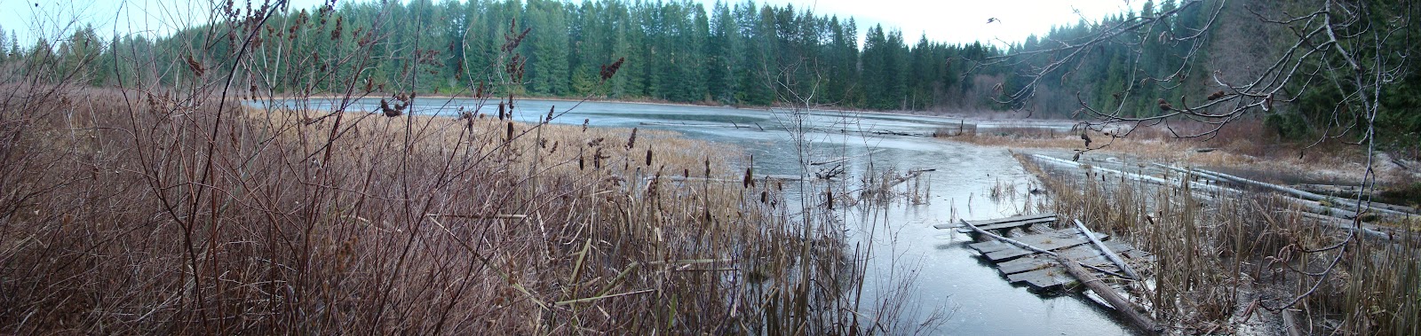
With all this snow around, I had to get a couple of shots of Round Lake frozen over, so I flew over in that direction before the sun got too low.

Round Lake frozen over.  Hard as rock... I bounced several fairly large rocks across it.

Terrific ride!

Saw two large 4x4 trucks coming through the tank traps on the way out.  Very impressive.  How they got those things through there is anyone's guess.

Oops, almost forgot the 3D anaglyph shots for the dorks with the red/cyan glasses!  Here's two:

Looking SW from Blackjack Ridge.  (Needs red/cyan 3D glasses).

Looking SW from Blackjack Ridge.  (Needs red/cyan 3D glasses).