Showing posts with label mount benson. Show all posts

Wednesday, July 25, 2012

Blackjack Ridge - Over the Top

I've ridden the trails up around Blackjack Ridge a few times now.  The views up there are amazing and it's always worth heading that way if I just have the time for a local ride.  But, every time I head up I stop at the same steep rocky section that heads over the top, leading eventually to the trails near Lucid Lake and the lower road that runs the SW side of Mount Benson.  I decided this time around to come at it from the Lucid Lake side, with a plan to turn back if the rocky, steep section looked too nasty from the top end.

Here's the route:

  
1.  Entered at Doumont
2.  Left towards Boomerang
3.  Left again
4.  Pass Boomerang and keep left
5.  Continued along length of Mt. Benson and turned up road that leads to Lucid Lake
6.  Followed creek bed leading up Blackjack Ridge.
7.  Through new gate.  (Logging roads look very new up here)
8.  Best view on Blackjack Ridge, overlooking Nanaimo Lakes
9.  Another nice spur road with an outstanding view
10.  The steep rocky section... heading down this time
11.  Descent towards Boomerang Lake
12.  Out


The uphill creek bed at #5
 
The creek bed continues like this for about a kilometer
 
New logging gate at #7.  A few newer logging roads connect up here.
 
180° Panoramic view looking SW from the best view location on the ridge (#8).
 
Nice section of spur trail (#9).
 
A shot along the power lines at #9
 
Just past this location the road begins a steep descent towards the spot where I decided against continuing on previous rides (#10).  It's a great deal easier going down, although there are a few spots where I slowed to a miserable crawl.  No pic unfortunately...  It's funny how the thought of photos disappears when your watching your front tire so carefully.  :) 

First and Second Lake from location #8
 Great ride.  I want to return to look at the lake just 0.7 km east of location #8.  Google Earth shows an unnamed, frozen-over lake about half the size of Round Lake.  Next time!


gpx track

kmz track

Sunday, July 15, 2012

SE Shore of Lucid Lake - Good Fishing Spot!

Just a short local ride today.  I left the house with the intention of fishing at a local no-name lake about 1km NE of Round Lake, (dubbed Dragonfly Lake by some of the more "flowery" local residents).


There were elk standing on opposite sides of the lake today.  They called each other across the lake for the whole time I was there... excellent entertainment, and much better than the fishing as it happens!  I bait fished there for about an hour, and after twiddling my thumbs and seeing no rising fish, I took off with a better plan in mind.

I thought it might be interesting to find the NE shore of Lucid Lake.  Paul and I had watched a fisherman on the NE side of the lake when we visited the lake for the first time last year.  Coming from Doumont Trail, continue past Boomerang Lake, keep left and follow the logging road that runs along the lower SW side of Mount Benson.  Almost 10km past the lake turn right and keep right at the next Y.  The trail opens up at the end to a large turn-around area with a fire pit at its centre.  This is the best place to park and begin a short hike to the right to get to the lake shore.  The trail does continue through a series of "tank trap" obstacles, but the trail eventually ends at a logged-out clearing some distance from the lake.

There must be a group of regular campers at this location:  A small lean-to, fire pit and a tall frame designed for some special purpose are located a few metres from the lake shore.  A small  fishing peninsula has been built, or at least added to, to get a line further out into the lake.  The lake's silty bottom looks relatively snag free except for the occasional weed here and there.  There were fish rising here!  Not many, but one alone was a 100% improvement on Dragonfly Lake.

It was late and there was no time to fish today, but this spot will make a good alternative for one of our local fishing spots.


GPX File: Doumont Trail to Lucid Lake.


Sunday, October 23, 2011

Fourth Lake Dam

Wooohoo, there's a window appearing in the local weather.  It looks like a rain free day... perfect for a quick ride out to the Nanaimo Lakes area.  Nanaimo has a series of lakes that run west from the south end of the city.  The area is owned by a large logging company who open their gates on weekends for campers to travel the logging roads into campsites on the lakes.  I was heading for Fourth Lake today, the last of the Nanaimo Lakes, to try some fishing off the dam if possible.

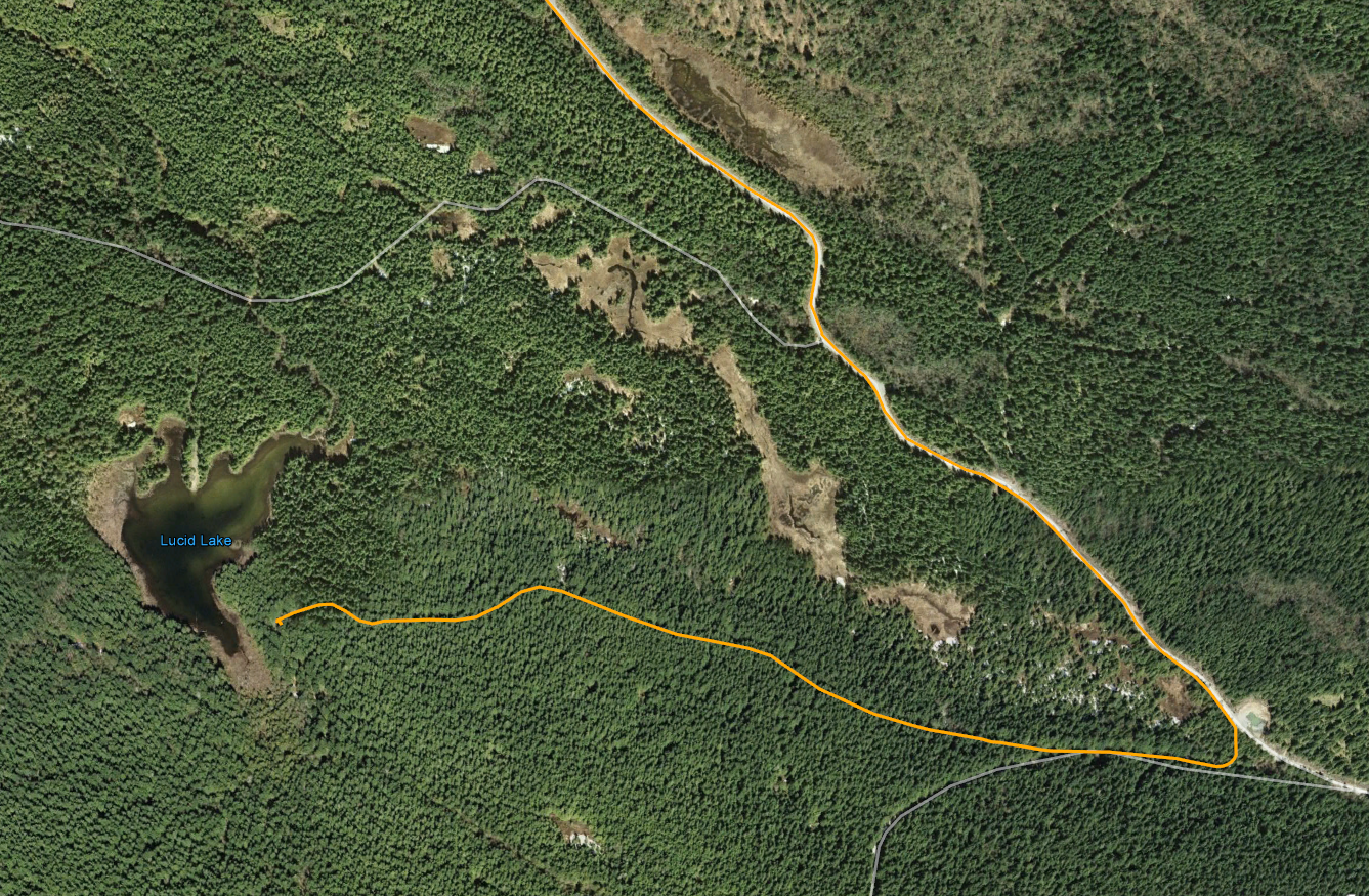
The route (Click to enlarge)
I picked the route heading south behind Mount Benson to keep it interesting rather than heading through the city.  I entered the logging roads through Weigles Road and headed through the worsening gummy tank traps.  (I got my bike stuck in a pool of sludge going through there today).  I followed the route I had taken on an earlier ride with Paul, past Boomerang Lake and down to the locked gate that exits onto Nanaimo Lakes Road.  The work-around is to the right of the gate and leads through a series of hills and pools that have been pretty overrun by quads that like to churn up the mud.

The "work-around" to the right of Nanaimo Lakes Road gate
The gate "work-around"
After ten minutes of navigating on foot to check if parts were passable I emerged onto Nanaimo Lakes Road and made my way on real roads to South Forks Rd.  This road takes you directly to Nanaimo River Road, the stretch of road that leads to all of the lakes.

Some miles along you reach an opened gate.  There was a gate keeper there today, as there is on most weekends, and he took my name, address, phone number and licence number.  I was instructed to check back out before five-o-clock.

First Lake is just beyond the gate.  I could see trout swirling around near shore and I wish now that I'd taken the time to stop there to fish for a while.  I wanted to move on and try fishing at Fourth Lake and still get out by five so I went on.

Second Lake
The logging roads are in great shape all the way through the lakes area.  I wouldn't take a regular car through there, but it's quite manageable for a 4x4 truck or trail bike.  After a few turns, approximately 30 minutes after passing the gate guy, I reached a Y in the road and a sign pointing left to "Fourth Lake."  The lake is only a few minutes ahead after climbing a small hill.

Left for Fourth Lake.

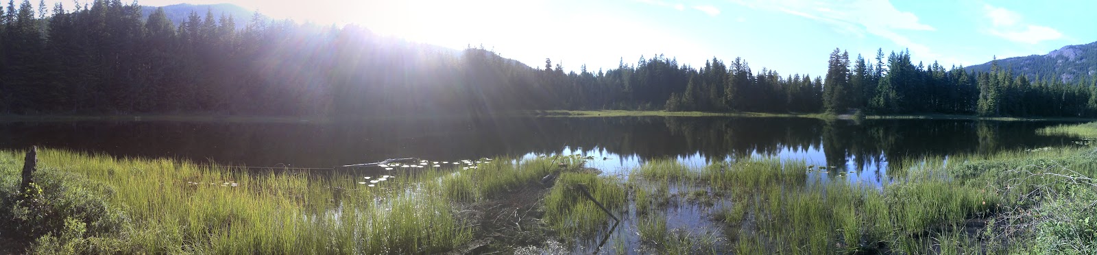
I turned right at the lake and drove along the length of the dam itself.  You can't fish easily off the dam, but there are many spots visible along the shore nearby.  I rode off towards the end of the Fourth Lake campsite and found a good spot on the lake shore for fishing.

The far end of the dam

Looking along the dam towards the road.  That's my fishing spot on the shore near the yellow tree furthest to the right.
Taken from the dam looking SW
Cheesy self-timer shot off the dam wall.
Further round the lake... This is the campsite area.  I fished from this spot.  That's the dam on the left.
The dam
Looking SW down the lake

I fished for about forty minutes and got many hits but I only managed to pull one in, a tiny trout that I was determined to keep.

The monster of the lake

I followed part of the same route home, but this time I opted for a trip through the city because it started to rain.  Altogether it was a really good ride and one that I'll repeat again.  Next time I think I'll stop at First Lake to do some fishing though.

That was five hours of wicked entertainment, traveling 140Km through some fantastic terrain, and the whole thing cost me $5.80 in fuel.  Not bad value since I brought a fish home too.  ;)