
Here's yesterday's route:

1. West on Doumont Trail
2. At "Intersection D" turned right towards power lines trail(left goes to Blackjack Ridge).
3. Attempted what appeared to be a clear and easy route into the Decosmos area roads, but this trail terminates abruptly at the North Nanaimo River. Definitely no way through here. Might have been a bridge in place at one point.
4. Traveled towards Blackjack Ridge on "power lines trail" toward a second trail that appears to be heading in the Decosmos direction.
5. Superb narrow mud trail. Very green and very clear. A few pools to ride through, but nothing too problematic.
6. Trail stopped at the North Nanaimo River once again. The river is fast flowing and deep and can't be crossed easily.
6b. (Forgot to number this on my map) :) The small spur NE of 6 leads across a brook towards what appears on my gps maps as a small lake. Came to a dead end.
7. Tried two spurs in the hope that they might connect to the Decosmos Trail. No dice.
8. Connected with the familiar trail that runs the length of Blackjack ridge.
9. Went looking for Paul who I figured might be at Kidney Lake.
10. Back to Doumont.
 |
| Detail of location 6 from the image above. Interesting looking spot. I wonder if it's worth fishing here? The river moves rapidly through here, but there are spots where the action slows down and I'm guessing there are fish hanging about. Could be busy because it's easily accessible from the other side where a major logging road comes up directly from Nanaimo Lakes Road. |
 |
| The trail entrance leading to location #3 (above). I thought this was a dead cert. I should have looked closer on Google Earth because it's pretty clear when you zoom right in that it doesn't go though. |
 |
| North Nanaimo River looking west |
 |
| End of the road at location #3 |
 |
| Next attempt at location #4: A right turn off the power lines trail heading off towards Decosmos. This trail was fun! |
 |
| Pool on straight section before location #6. It's pretty fine sand and silt here. Gave me no problems coming in, but I sank deep enough to give the engine a good wash on the way back out. |
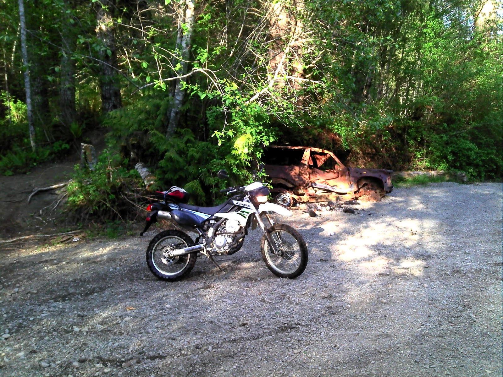 |
| Old 4x4 wreck at location #6. Let this be a lesson to all of them! |
 |
| Location #6 again. Parked at the North Nanaimo River. Nice spot. |
 |
| Small brook (North Nanaimo River tributary) I crossed this to continue towards location #7 (and "6b") |
 |
| One more small brook. I stopped here. This trail appeared to be going nowhere in particular and since I was still looking for a route towards Decosmos, I turned back. It's the dead end shown on the route above, NE of location #6. Map shows a small lake and Google Earth shows a nasty looking, boggy excuse for a lake. |
 |
| 128 degree panoramic of the North Nanaimo River. (low res. made from GPS photos) |
That's it. Great 55.5Km ride. Must go back and try that river for trout.
_____________________________________________________________________________________
 |
| Had to throw in my Boomerang Lake trout from the day before. Yumm! |
No comments:
Post a Comment
Please Leave a Comment: