

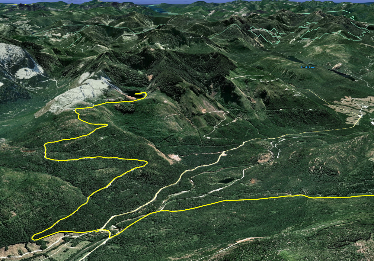
1. Began at Doumont Road and went through the tank traps before turning left.
2. Travelled over the new bridge... No new yellow gate :)
3. Turned right at Boomerang Lake's southern intersection.
4. Followed power lines trail. (Many improvements have been made to the roads here... The loggers may be busy soon).
5. Turned right off of power lines route onto Okay Mt. valley road.
6. Turned left onto 155 Main.
7. Turned left onto 155N.
8. Travelled up the ridge road. (It was cloudy and rainy today... No views of Mt. Moriarty).
 |
| Blueberries on the ridge road |
9. Went through the "key trail" and turned left onto a possible alternative to having to descend through the alders as we usually do on this road.
10. Fought our way through heavy young alder growth. (It was heavier than the standard route).
 |
| mossy road surface on the "alders alternative" road before we encountered heavier alders |
 |
| Paul reaches a clearing along the "alders alternative" |
 |
| Sebastian emerges through the alders |
12. After deciding that the trees were too thick we retraced our steps and followed the usual road through the alders towards Nanaimo River Road.
 |
| those alders will grab onto anything from front brake levers to cameras |
 |
| (top left to bottom right) A small trail left of gate provides access. It's difficult to see the road you need to follow when looking on Google Earth. Follow an immediate fork to the right after the gate. Both forks head to the lake although the right fork is more direct. |
14. Uphill road to Heart Lake. It's a steep but fairly easy ride. There are many drainage ditches on this road that keep your speed in check.
 |
| climbing up towards the lake |
15. Heart Lake at near 900m. Beautiful lake with a depressing "grapple-yarded" mess of logs and stumps on the far shore. What a terrible mess these people have made of one of our beautiful lake areas! :( Surely there are other spots you could have logged.
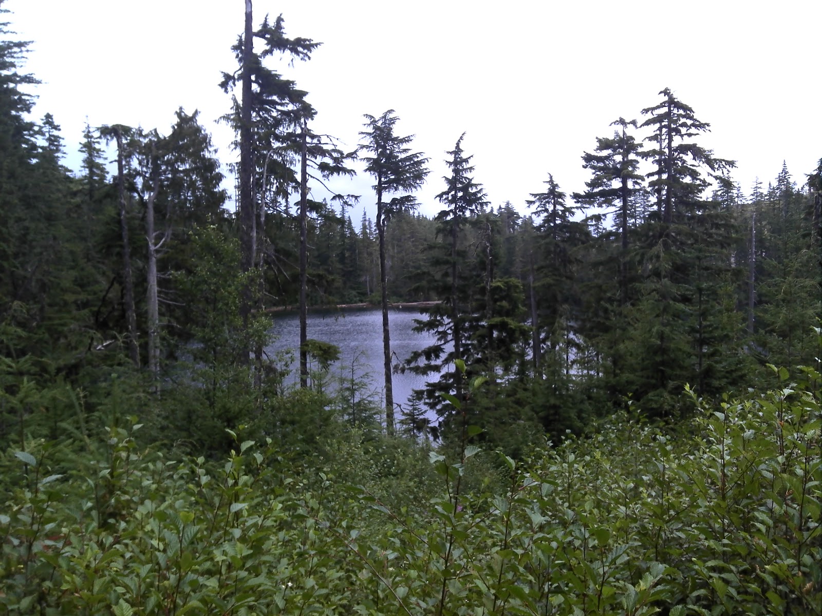 |
| approaching the lake |
 |
| 290° stitched panoramic from the western shore of Heart Lake |
 |
| good fishing cliffs on western shore |
There are a number of good fishing spots on the road side of the lake. Some spots are off of low cliffs while others can be found nearer to the water level. We fished for a little over an hour today, (I think), and we saw very little action. Eventually we walked out with three fish between us. We saw a bear on the far side, which helped to make things more interesting. (Unfortunately, the bear was looking for trees and had less luck than us).
One of us took a spill on the way out. No large injuries luckily... Just an improved healthy respect for downhill logging roads with ditches. ;) Lesson learned!
It was a terrific ride and it appears that we all really enjoyed it except for the spill.
Here's our route spelled out on my GPS map at 100x real time. (If you increase the resolution at the bottom right of the window, you can read the writing without squinting). :)
Another good looking ride Andy. I really like the software you use that shows the elevation of the ride. Keep on riding!
ReplyDeleteAwesome commentary and descriptions of the area. Will explore with my son. Thanks!
ReplyDeleteThanks. Are you a quad rider? We need quads to follow the alder covered roads up that way before we lose the roads to nature. It's a great way into the lakes area without passing thru a yellow gate. If you try it, can you post back here? :) Thx for the comment.
Delete