Saturday, February 04, 2012

Cheesy Timelapse Video of the Doumont Trail

I've been waiting for weeks for the weather to clear up enough to head out for a ride.  A window appeared today after waiting hours for the fog to clear up, so I left for a ride up the Doumont Trail around 2:00pm.  I've been playing around with a $1.99 app on my iPod Touch called "Time Lapse" and I wanted to give it a whirl on the bike.  It works well in the car when it's pointed down a long stretch of road and when it's not being bounced around like a cocktail shaker, but on the trails it's going to be a different story I think.  The results weren't too great.

There's still a fair bit of snow and ice up there on Doumont.  I felt the rear wheel slip around quite a bit today and so I didn't go too far up the trail.  I turned a few hundred metres before the tank traps.  Come on springtime!

Here's the cheesy video:


Sunday, January 08, 2012

"There's Gold in Them There Hills:" Proposed Route #5

Got out again yesterday and rode the Sundew Gate to Weigles Rd standard route.  It was quite wet but it was fantastic to get out on the bike again if only for a short spell.  I'm amazed at the continued change in conditions on some of the local logging roads:  There are many spots where streams have chewed up the hard packed gravel road surface.  This is nothing new to a seasoned trail bike rider from this area, I'm sure, but it's sure catching my attention lately.  The tank traps really make me laugh lately.  There's a six inch wide route that I like to take through the quagmire... If I mess with my six inch strip, I'm stuck in the goo.  Anyway, I thought I'd post another proposed route today.  Here's another climb up Mt DeCosmos planned for after the snow melts in the spring.  Proposed route #5:

I was surfing the internet, looking at mid Vancouver Island mines, (closed historical sites).  I found an interesting page offering a parcel of land for sale in the Nanaimo region with a proven gold mining site.  The article described the mine site itself to be behind a small waterfall on Deadhorse Creek in the Mt DeCosmos area.  So, I now have an approximate position of the land for sale, the creek and a possible location for the mine/waterfall.  The trail to the mine continues up Mt DeCosmos for some distance to a second summit location which looks like it will offer spectacular views of the Nanaimo Lakes Area.  (Here's the webpage with the land for sale).

Here's some Google screen snags:

The route in orange begins at the end of Second Lake on Nanaimo Lakes Road.  The first "possible location" shown is another reference I found to the mine.  I think this might be an inacurate "within 500m" type of reference that refers to exactly the same mine.  The white squared boundary is approximate location of the mining land that's for sale.  The blue line represents the location of Deadhorse Creek.  The bright green line shows the final spur leading to the summit ridge.  It might be a bit too hairy for a ride, but a hike up this final trail would be well worth it to get to the view.  (Great geocache location too).  Red arrow shows the highest point on the road.  The elevation profile shown at the bottom looks at the orange route from lake to summit, with the vertical line showing the high point (red arrow) position.

Same roads viewed at an angle to show the contours better.

A detail of the creek in blue.  Approximate mine location is shown with the red arrow.

A detail of the final spur road in green.  The red arrow shows the high point in this trail and also the beginning of a section that may prove too difficult to ride.  We'll have to see.

Google Earth view looking East

Google Earth SW View


Two panoramic views from the top of DeCosmos:  The first is a 360 degree panoramic photo and the second is a winter 128 degree panoramic.  Both were created from YouTube videos using Microsoft's Image Composite Editor (free software).  

 
I'm really looking forward to this ride.  Looks like a full day if that mine is to be included in the ride.  Better bring a gold pan on this one!

UPDATE:  We did this ride in the summer of 2012, and we found the mine.  See here for details.  

Monday, January 02, 2012

As the Weather Gets Colder, The List Gets Longer


What do you do when it's too cold, wet or dark to ride up a mountain?  You plan which mountains you're going to ride up when it gets warmer.   Here are four "must do" trips for some time after the melt. 


Click to Enlarge
 Something tells me my local rides aren't going much past Boomerang Lake for a spell.  :) 

Second Route to Rhododendron Lake?

It looks like it's possible to get to  Rhododendron Lake a different way when you follow the logging roads on Google Earth.  The previous time Paul and I rode out to the lake, we passed a very well-groomed logging road near the lake that followed the power lines to our left.  This is the same powerline route that can be entered while riding the lower section of Blackjack Ridge.  The road looks really good on Google Earth, so I marked out a GPS track and fired it off to my smokin' new Garmin Montana!  Here's the intended route:


 Unfortunately the route turned out to be a dud for this time of year, or at least it's a dud with my trail biking skills at this time of year.  Shortly after crossing the rotting bridge on the early part of the Blackjack section of the powerline trail I came across some very deep rocky pools that blocked the road entirely.  I was determined to get through initially and I blasted into the water; it covered the engine entirely and I found myself jostled over four or five large boulders that couldn't be seen through the water.  Remarkably, I made it through pool #1, (after sharing some choice expletives with the wildlife), and I was faced with a choice:  Continue through this lot and possibly find more of this crap, or turn and go back through the last nasty section, hopefully without dumping the bike in the drink.  I turned back!

Here's the first pool.  (Marked as a marsh section on my maps).  This nasty is much deeper than it looks.  I was really surprised when I hit those boulders in there too.  :)  Photo was taken with the Garmin.  The res is lower, but the geo tagging rocks.
I decided pretty quickly, after getting back through this thing, that it's a spring or summer route.  I don't think the water would have continued much after this section since it's marked as marshland on my map, but it wasn't worth the risk continuing by myself.

Here's the actual route taken:


The Tank traps are nice and gooey these days and careful navigation is a must if you don't want to get stuck in the gumbo.  The creek bed leading to the traps was flowing very quickly;  you find yourself riding the length of a small river for a short distance.


So, it didn't pan out this time around.  The route is saved in my GPS and I'll definitely retry the route in the spring.  I'm really keen to see what these winding roads look like as they weave their way in and out of the power line clearing.

Thursday, December 22, 2011

Another Look from Beautiful Blackjack Ridge

I went up Blackjack Ridge again today.  I've been wanting to tryout the longer trail that travels along the length of the ridge because it looks like the views would be pretty spectacular from up there.

Here's today's route:

Entered trails from Weigles Road entrance (left to right).  (Click to enlarge).
 

It was really bloody cold out there today.  I met snow near the top of the ridge and chickened out from completing the route as intended, stopping instead to take panoramic photos SW from the ridge.  My original plan had been to go beyond the longer purple line above by about 1.5km.  That would have taken me to the best viewpoint on the ridge.  I really want to check out the rest of the route when the snow melts, although I have a feeling it's going to be white for a while up there.

Snow!!  Pretty nasty in places too.  Perfect for slowing the riding down a tad.  There was just enough gravel here and there to avoid the ice patches.

As high as I got today.  (End of the purple line on route map).
  
SW facing, 180 Panoramic from the ridge (Magenta line on route)
 
Overlooking Blackjack Lake... Facing SW.  (Magenta trail on the route).
 
180 degree panoramic image (low res) made from a video I took.  (Magenta trail on the route).
Same trail
With all this snow around, I had to get a couple of shots of Round Lake frozen over, so I flew over in that direction before the sun got too low.

Round Lake frozen over.  Hard as rock... I bounced several fairly large rocks across it.

Terrific ride!

Saw two large 4x4 trucks coming through the tank traps on the way out.  Very impressive.  How they got those things through there is anyone's guess.

Oops, almost forgot the 3D anaglyph shots for the dorks with the red/cyan glasses!  Here's two:

Looking SW from Blackjack Ridge.  (Needs red/cyan 3D glasses).

Looking SW from Blackjack Ridge.  (Needs red/cyan 3D glasses).

Sunday, December 18, 2011

Two Views from Blackjack Ridge

I took a ride by myself today and went exploring a couple of Blackjack Ridge spurs off the main Blackjack logging road.  Here's the route in from Weigles Road/tank traps:

The Big Picture

Zoomed In on the Route (Right to Left)
It was really boggy through the tank traps today.  Easy riding on the way in, but a bit nasty on the way out with rear wheel spins through the gumbo. 


I turned left onto this small trail off the main Blackjack route.  The early part of this trail gets quite steep, but soon settles down to a very comfortable climb on an excellent small rock chip and sand base.  I stopped to take pictures from both dead-end spurs.


Viewpoint One  (180 Degree Panorama)
Viewpoint Two  (180 Degree Panorama)

 The ride down is a perfect example of a ride where you DON'T WANT TO TOUCH THE FRONT BRAKE TOO HEAVILY:  Steep with deep sand in places.  There were plenty of ice chunks on the trails today, (real pink fingers weather), so on the way back I took a quick peep at Boomerang Lake to see if it was iced over.  It wasn't iced over, but it was well on its way.  I'll have to come and take a look at it around January.   

Half Frozen Boomerang Lake
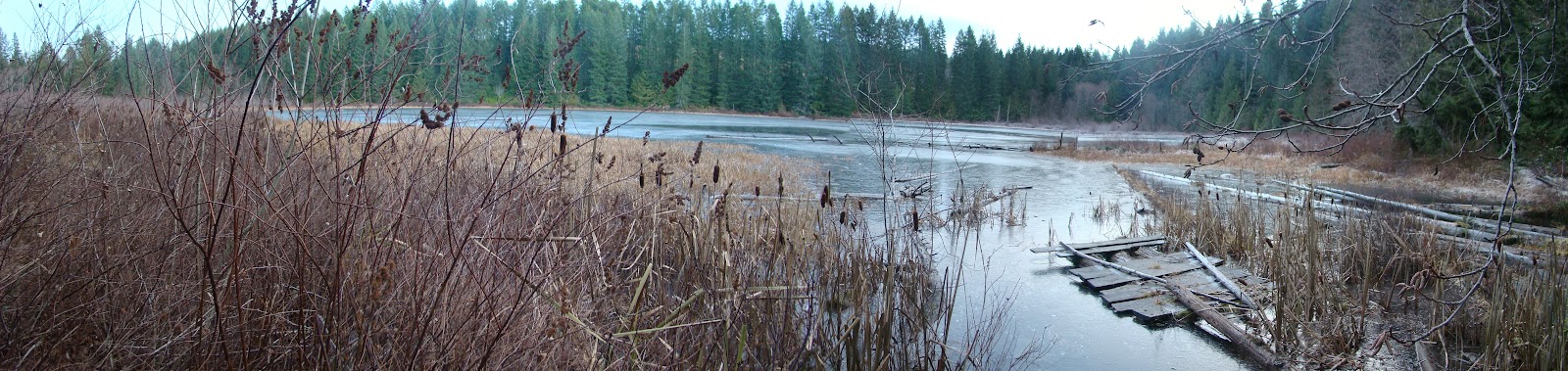
 The new fishing dock that some kind soul put in place has almost floated away with the rise of water level in the lakes.

Cottle Lake had even more ice.  The rings are where people have tried breaking the ice with rocks.
Great ride...  Time for a wash!
Now for the 3D Anaglyph image for the dorky people with red/cyan glasses (view full size):