Showing posts with label lake. Show all posts

Saturday, August 04, 2012

Doumont Road to Cowichan Lake with NO GATES!

We set out today to look for a second possible route to Moriarty Lake, an alternative to our new "key trail" which allows us to get through to the Nanaimo Lakes without passing through a Timberwest gate.  We got skunked unfortunately and we were unable to find a possible joining trail that Paul had picked out on Google Earth.  We decided instead to use the standard "key trail," make our way to the Nanaimo Lakes and then push on past Fourth Lake to Cowichan Lake.  If nothing else we could check the state of the gate just past Fourth Lake.

Here's our route:

 
1.  Entered at Doumont Rd.
2.  Turned onto the 155 Main logging road
3.  Turned left off of 155 towards mountain ridge NE of Moriarty Mountain onto 155N
4.  Looking for alternative route to Moriarty Lake
5.  Shelton Lake
6.  Passed Fourth Lake turnoff to our left
7.  Mountain pass... NO GATE
8.  Paved black-top section - Logger's highway to Cowichan!
9.  Through Youbou...  Supper in Cowichan Lake & #1 highway home

So, we got past Fourth Lake and stopped at the approximate cross-over location between two local logging company's boundaries where the gate should be.  There was no gate!  We've been wondering about this gate for quite a while now, and it appears that it's nothing but a figment of my imagination.*  I had imagined there must be a gate between the two borders since they went to the bother of removing a bridge at a similar location not far from here.  I had managed to convince us all about the problem of getting around this gate that never existed.  :) 

*  Oct 27/12:  Just saw the gate position shown in an old "V. I. mapbook," so I'm not delusional after all.

We saw some really great looking logging roads in this area that we must get back and try another day.  One in particular climbs steeply towards the SE and it looks like it would have some fantastic views of the pass we were riding through.  The road through here, an "S" that makes it's descent through the mountains north of Sadie Peak, are not nearly as difficult to ride as I had imagined.  Google Earth's exaggerated 3D view makes it look like you're about to ride the Himalayas, but the road is in pretty good shape and the steeper grades are hardly noticeable.

Mountain Trail  Heading SE through the Mountain Pass
 
We eventually reached a really good black-top section of road that takes you a fair distance towards Cowichan Lake.  You can reach speeds of 80km/h if you watch carefully for the odd crater and the occasional not-so-smooth transition between gravel road and tarmac.  This great little road follows the Nitinat river and offers some terrific spots to stop and check out the view.

Smooth Black-Top Between Fourth Lk. and Cowichan Lk.
 
We passed our previous route into Marcus Lake, (although I forgot to notice the turn as we rode through).  This will definitely be the route we take next time we take off for a camping trip into that area;  it's a far better alternative than being forced to take the highway down through Youbou as we did last time.

We continued on towards the east and drove the northern shore of Cowichan Lk. through Youbou and onto the town of Cowichan Lake for supper.  "Jake's at the Lake" is a great place to eat if you're going through town.

We blasted up the highway from here.  It's a much more boring way to travel, but we were feeling pretty satisfied from our tremendous ride from Doumont to Cowichan without hitting one logging gate!

Kudos to Paul for oiling up his plugs and riding back at 100km/h so my 250 wouldn't melt.  ;)  

Wednesday, July 25, 2012

Blackjack Ridge - Over the Top

I've ridden the trails up around Blackjack Ridge a few times now.  The views up there are amazing and it's always worth heading that way if I just have the time for a local ride.  But, every time I head up I stop at the same steep rocky section that heads over the top, leading eventually to the trails near Lucid Lake and the lower road that runs the SW side of Mount Benson.  I decided this time around to come at it from the Lucid Lake side, with a plan to turn back if the rocky, steep section looked too nasty from the top end.

Here's the route:

  
1.  Entered at Doumont
2.  Left towards Boomerang
3.  Left again
4.  Pass Boomerang and keep left
5.  Continued along length of Mt. Benson and turned up road that leads to Lucid Lake
6.  Followed creek bed leading up Blackjack Ridge.
7.  Through new gate.  (Logging roads look very new up here)
8.  Best view on Blackjack Ridge, overlooking Nanaimo Lakes
9.  Another nice spur road with an outstanding view
10.  The steep rocky section... heading down this time
11.  Descent towards Boomerang Lake
12.  Out


The uphill creek bed at #5
 
The creek bed continues like this for about a kilometer
 
New logging gate at #7.  A few newer logging roads connect up here.
 
180° Panoramic view looking SW from the best view location on the ridge (#8).
 
Nice section of spur trail (#9).
 
A shot along the power lines at #9
 
Just past this location the road begins a steep descent towards the spot where I decided against continuing on previous rides (#10).  It's a great deal easier going down, although there are a few spots where I slowed to a miserable crawl.  No pic unfortunately...  It's funny how the thought of photos disappears when your watching your front tire so carefully.  :) 

First and Second Lake from location #8
 Great ride.  I want to return to look at the lake just 0.7 km east of location #8.  Google Earth shows an unnamed, frozen-over lake about half the size of Round Lake.  Next time!


gpx track

kmz track

Monday, July 16, 2012

Doumont Rd. to Moriarty Lake and Nanaimo River Rd.

FINALLY, we did it!  We managed to punch through to Moriarty Lake and Nanaimo River Road from the north.  We tried this a few weeks ago when there was still snow up in the nose bleed region, (1015m).  This time, the ridge we were climbing to the east of Mount Moriarty was clear all the way, (sweltering hot actually), and we were able to ride right over the top at 1090m (3576ft).

Here's the route in brief:


1.  Started at Doumont Rd. entrance to logging roads
2.  Turned right at the intersection NW of Boomerang Lk. onto Branch 142
3.  Left onto 155 main
4.  Turned left off of 155 towards mountain ridge NE of Moriarty Mountain onto 155N
5.  Passed "snow" waypoint
6.  Turned right onto key trail linking the northern logging roads to the southern roads (thanks Google E).  There's a nasty downhill section full of young alders shortly after this location. 
7.  Right turn to Moriarty Lake
8.  Lunch at the lake shore
9.  Descent towards Nanaimo River Rd. on Branch G
10.  Nearly went to 4th Lake... oops.  (I've been staring at this route for too long).
11.  NO GUARD at the gate on Nanaimo River Rd.  Their schedule is extremely odd!
12.  Turned left to follow the lower Blackjack Ridge route back to Doumont
13.  Doumont Rd.

Plenty of dust out there today.  The logging trucks were working and we had a few of them blast past us doing 9 869 862 km/h, leaving us confused and dazed in a cloud of thick dust.  The bikes were kicking up plenty too, measurable by the layers of dirt up my sinuses.

The ride up the ridge, (a left off of 155 Main), was noticeably different from the last time we came this way:  The dryer weather and some wear from quads and bikes have loosened dirt and rocks making the road surface quite a bit looser than we both remembered it.  It was pretty easy going, only the wheel had a tendency to spin out more times than last.  It's a great climb up there...  I love how Moriarty Mountain opens up on your right as you get higher.  The weather was so good today; it would have been a good day to bring my decent camera.  Hindsight is 20/20...  I was stuck with only my GPS pics again.

We reached the end of the road as planned and explored the "brownish key trail" we have both been spying on Google Earth, (item 6 above).  Part of me thought this was going to be a complete waste of time and I thought we were in for a line of dead branches and stumps that only appeared to be a trail from satellite.  I was delightfully surprised!


A big log marks the entrance on the right, which starts about 120 yds before the end of the road.  This short joiner trail is about 100 yds long.

It was a good quad/bike trail and had obviously been carved into place by riders who were doing exactly what we were doing;  looking for a route to the lakes and Nanaimo River Road.  i.e. Getting access to the Nanaimo Lakes area even when the logging gates are closed.  (Of course, this is completely legitimate, otherwise there would be signs posted to prevent it).

We made it through with little trouble.  Occasional ditches have been strategically placed to make access more difficult than a straight trail, but these ditches are more of a mild nuisance than a trail stopper.  We continued downward through a series of these ditches, perhaps four or five.

After descending a fair way we reached a "T."  From here you can turn right to Moriarty or left to Nanaimo River Road and Fourth Lake.  Time was an issue today and we decided on saving the " check Fourth Lake gate" ride for another time.  (Note, Aug 31/12:  We've discovered there is no gate.  Hahaha). We began to climb once more and than started to descend towards Moriarty Lake.  There are terrific views of Moriarty Lake and a couple of other no-name lakes as you crest the round road leading to the lake.  We stopped at a large "tank trap" at the end of the road and decided to walk the remaining 170yd four iron shot to the lake.  Ahhhh, lunchtime at the lake.

Moriarty's Lake Shore


We rode the circle road once again and arrived back at the "T" intersection.  Continuing straight we rode a steady and quite lengthy descent down to Nanaimo River Road.  From here we continued along the less-than-exciting N. R. Rd. back towards more familiar logging roads and zipped straight through the unguarded open gate.  This annoys me!  They stopped us a week ago when we attempted to ride through here and turned us back with fully loaded bikes, forcing us to ride the #1 highway down to Cowichan Lake.  Today, they decide that it's okay to leave the open gate unattended.  Who's writing their rule book?

A quick left turn took us back onto more familiar roads.  We rode the lower Blackjack Ridge road back past Boomerang Lake and followed the tank traps back to Doumont.

What an outstanding ride today!  Finally, we conquered Moriarty Lake and we found a way through to Nanaimo River Road and beyond.  :)  It might be a bit of a struggle going the other way, although it looks quite do-able.  We'll see. 

Quad riders:  We need you guys to ride between location 6 and 7 to help stop those alders coming through the road!  :)


Sunday, July 15, 2012

SE Shore of Lucid Lake - Good Fishing Spot!

Just a short local ride today.  I left the house with the intention of fishing at a local no-name lake about 1km NE of Round Lake, (dubbed Dragonfly Lake by some of the more "flowery" local residents).


There were elk standing on opposite sides of the lake today.  They called each other across the lake for the whole time I was there... excellent entertainment, and much better than the fishing as it happens!  I bait fished there for about an hour, and after twiddling my thumbs and seeing no rising fish, I took off with a better plan in mind.

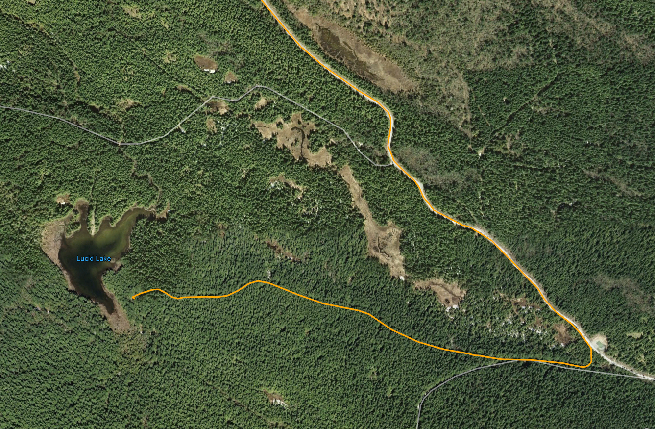
I thought it might be interesting to find the NE shore of Lucid Lake.  Paul and I had watched a fisherman on the NE side of the lake when we visited the lake for the first time last year.  Coming from Doumont Trail, continue past Boomerang Lake, keep left and follow the logging road that runs along the lower SW side of Mount Benson.  Almost 10km past the lake turn right and keep right at the next Y.  The trail opens up at the end to a large turn-around area with a fire pit at its centre.  This is the best place to park and begin a short hike to the right to get to the lake shore.  The trail does continue through a series of "tank trap" obstacles, but the trail eventually ends at a logged-out clearing some distance from the lake.

There must be a group of regular campers at this location:  A small lean-to, fire pit and a tall frame designed for some special purpose are located a few metres from the lake shore.  A small  fishing peninsula has been built, or at least added to, to get a line further out into the lake.  The lake's silty bottom looks relatively snag free except for the occasional weed here and there.  There were fish rising here!  Not many, but one alone was a 100% improvement on Dragonfly Lake.

It was late and there was no time to fish today, but this spot will make a good alternative for one of our local fishing spots.


GPX File: Doumont Trail to Lucid Lake.


Friday, April 27, 2012

Kidney Lake Bonanza!

Took a nice ride out to Kidney Lake after work today.  When I arrived the lake was calm and full of rising fish.  I couldn't get the line in the water fast enough.  Caught a trout on my third cast!  Five in all today, six if you include the one Paul caught when he showed up late and stole my spot.


Tried bait fishing for a short spell, but no dice.  They were going for gold spinners today.


Wee bit o' rain, but generally pretty dry.  Great day at the lake.


Friday, April 20, 2012

Friday Workday... then FISHING! Ú·

I zoomed out of work really quickly today so that I could get a few hours of fishing in at our local lakes and by 4:00 I had a line in the water at Kidney Lake.

It was a great ride down there:  1Km before the lake I heard a thunderous clatter to my left and made a mad scramble for a camera as a herd of 8 to 10 elk crossed the road right in front of me.  They were pretty spooked by my bike and so they moved really quickly to conceal themselves in the trees to my right.  I managed to get one shot off with my Garmin which was close at hand, but got nothing of the herd.  So, off I went with my heart pumping about twice its normal rate only to meet a single female still looking for the herd.  She gave me a bit more time and loped well ahead of my position so she could cross over to the other side.  I captured her with the Garmin...  Not a quality shot, but at least I got it!  Totally thrilling watching them motor by like that!

Purple route from "Intersection A" (bottom right) to NE end of Kidney Lake.

Get out your magnifying glass!  She's that clump of pixels near the centre!
 
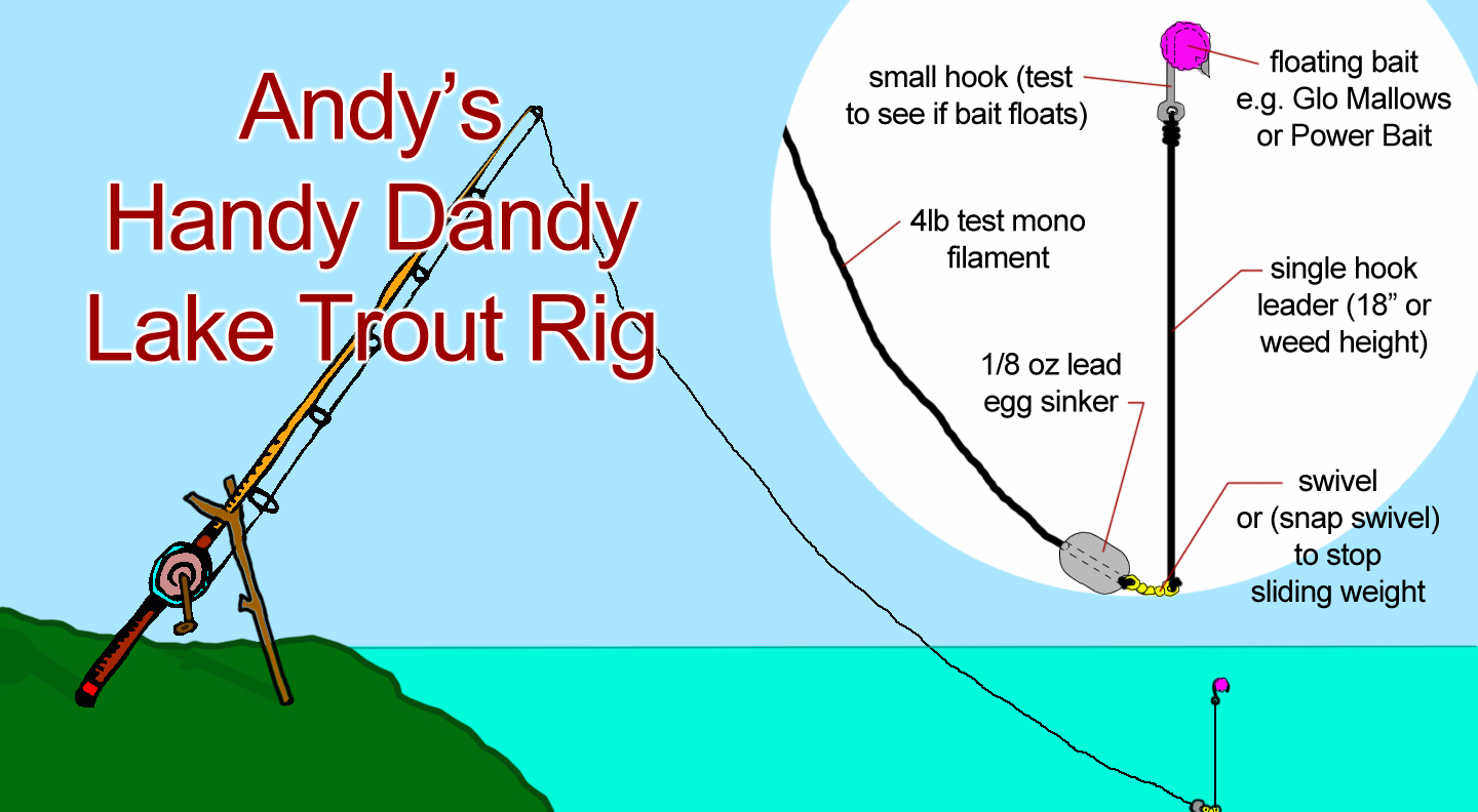
So, I got down to the lake and fished with some bait for a change.  I set up "Andy's Handy Dandy Lake Trout Rig" which consists of an egg sinker (1/8lb lead weight that slides freely on the line), a swivel clip (which doubles as a stopper to keep the weight on) and an 18" leader attached to the swivel for floating bait.  For bait I used yellow and orange scented Glo Mallows.


The beauty of this rig is that it allows the line to slide freely through the weight.  That means that when the trout hits, it travels away with the line unimpeded by the weight and sets the hook when the slack is taken up.  It's perfect for stocked trout that have a tendency to hit aggressively in this way.  A small treble hook can be used also, providing it's small enough to be lifted by the bait (#14).  Great for molding bait around with Power Bait.  Also, leader length can be changed to match the weed height in any particular lake to keep the bait floating right at typical feeding height, (slightly above the weeds), for bottom swimming trout.

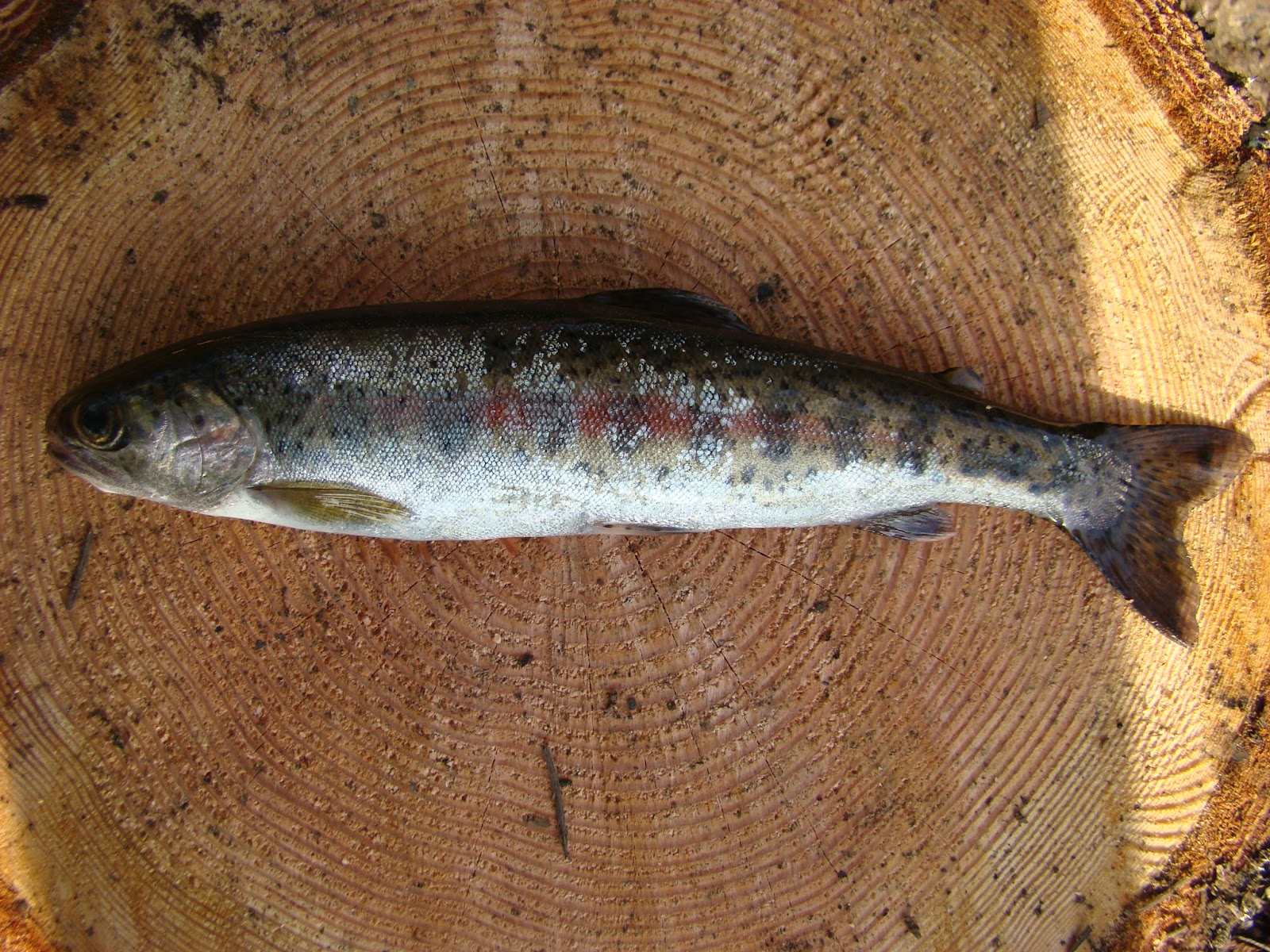
I fished that setup for about two hours without so much as a nibble today.  There was lots of action on the surface by 6:00 and so I switched to spin casting my "Super Duper" favourite spinner.  I caught the youngest and smallest trout in the lake with this.  IT WAS DELICIOUS!!

YUM

Friday, March 23, 2012

Finally, No Rain and Snow! Great Day to Ride to the Back of Kidney Lake

It has rained here for days and when it's raining down here the local mountains are getting a fresh dump of snow.  Well, the rain stopped today for the whole day and the temperature went up too.  I tried getting up through the Doumont Trail last week but there was so much snow it was impossible.  I thought it would be worth a try today.

I planned out a quick route on Google Earth...  Too snowy to pick a "must do" ride like the climb to Okay Mt. summit or Mt. DeCosmos.  I'm still busting to do them both, but right now I figured I should pick a much safer, lower and warmer spot!  I decided to try heading to the back of Kidney Lake using the trail I've seen quite a few times now as I ride from Sundew towards home.  I mapped it out, socked the route into the Garmin and off I went.

Route begins at "Start Doumont Trail" on the orange section.  Yes, there is a quicker way to this lake, but this is the only way to the SW side.  The return trip followed the same route reversed.

A close-up of the south heading red trail that leads to Kidney Lake.  (Line travels left to right).  Lower portion is an elevation profile, also reading from left to right.  The red arrow marks the high point in the trail.
A close-up of the lake.  We usually fish off the northern bank where the small photo icon is placed.  The lake is extremely difficult to reach where the road passes close by on its SE side;  That's a pretty steep hill.  
I met with a bit of snow and lots of slush going through the Tank Traps and the surrounding area, but generally the logging roads were clear of snow and ice.  The road in has been chewed up quite badly here and there, mostly by 4x4 trucks and quads.  Some spots are actually a bit hard to recognize.

180° Panoramic of the Bog leading to the Tank Traps.  I've been through this section enough now to pick a clean path through every time.  People get fooled by the easy looking dry section on this side of the bog.  It's a guaranteed "get stuck" route!  Stick to the wettest, boggiest looking section...  Easy as pie and not nearly as bad as it looks! 
Some snow patches are lingering in shadowed sections of the roads, but this is as bad as it got today.  Much better!  The darkened area just below the middle is a splotch of mud on my GPS.  :)

Beautiful clear day to view the Winchelsea Islands from the logging roads.
The new unexplored section of road (red trail) was in great shape.  It gets pretty craggy towards the lake and I needed to slow down for some sharp chunky rock sections, but on the whole I was able to ride quite fast on most parts.  There are a few turns here and there that are calling for a return trip.  The lake was easy to find!  As far as fishing goes, the north entrance to the lake is far better...  There are few, if any,  good locations for shore fishing on this side of Kidney Lake.

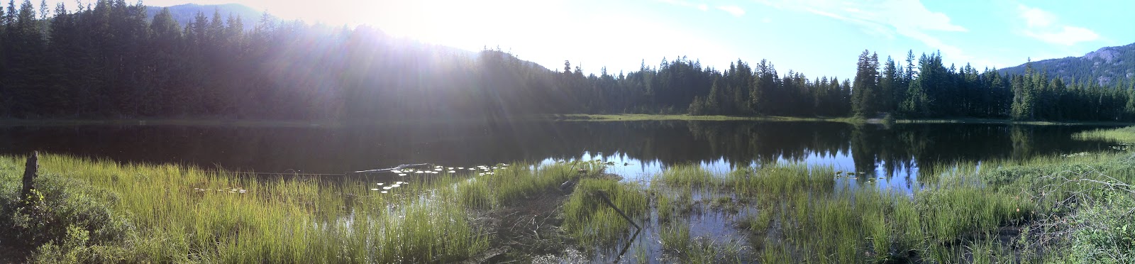
220° panoramic shot of the lake side.  Some kind individual had prepared a nice fire for me.  I needed a bit of warming up too!

170° Panoramic
Returning through the Tank Traps.  Actually past the traps here and about to enter the bog that goes off to the left side.  Gives me something to wash off when I get home.
Altogether a great ride.  It was terrific to get back out and ride properly without having to pick my way between chunks of ice and snowdrifts.  Here's a timelapse video of the red road section.  Looks way better if you up the Youtube settings to 720p.  Bit shakey... it was pretty bumpy at the end.  :)


Sunday, October 23, 2011

Fourth Lake Dam

Wooohoo, there's a window appearing in the local weather.  It looks like a rain free day... perfect for a quick ride out to the Nanaimo Lakes area.  Nanaimo has a series of lakes that run west from the south end of the city.  The area is owned by a large logging company who open their gates on weekends for campers to travel the logging roads into campsites on the lakes.  I was heading for Fourth Lake today, the last of the Nanaimo Lakes, to try some fishing off the dam if possible.

The route (Click to enlarge)
I picked the route heading south behind Mount Benson to keep it interesting rather than heading through the city.  I entered the logging roads through Weigles Road and headed through the worsening gummy tank traps.  (I got my bike stuck in a pool of sludge going through there today).  I followed the route I had taken on an earlier ride with Paul, past Boomerang Lake and down to the locked gate that exits onto Nanaimo Lakes Road.  The work-around is to the right of the gate and leads through a series of hills and pools that have been pretty overrun by quads that like to churn up the mud.

The "work-around" to the right of Nanaimo Lakes Road gate
The gate "work-around"
After ten minutes of navigating on foot to check if parts were passable I emerged onto Nanaimo Lakes Road and made my way on real roads to South Forks Rd.  This road takes you directly to Nanaimo River Road, the stretch of road that leads to all of the lakes.

Some miles along you reach an opened gate.  There was a gate keeper there today, as there is on most weekends, and he took my name, address, phone number and licence number.  I was instructed to check back out before five-o-clock.

First Lake is just beyond the gate.  I could see trout swirling around near shore and I wish now that I'd taken the time to stop there to fish for a while.  I wanted to move on and try fishing at Fourth Lake and still get out by five so I went on.

Second Lake
The logging roads are in great shape all the way through the lakes area.  I wouldn't take a regular car through there, but it's quite manageable for a 4x4 truck or trail bike.  After a few turns, approximately 30 minutes after passing the gate guy, I reached a Y in the road and a sign pointing left to "Fourth Lake."  The lake is only a few minutes ahead after climbing a small hill.

Left for Fourth Lake.

I turned right at the lake and drove along the length of the dam itself.  You can't fish easily off the dam, but there are many spots visible along the shore nearby.  I rode off towards the end of the Fourth Lake campsite and found a good spot on the lake shore for fishing.

The far end of the dam

Looking along the dam towards the road.  That's my fishing spot on the shore near the yellow tree furthest to the right.
Taken from the dam looking SW
Cheesy self-timer shot off the dam wall.
Further round the lake... This is the campsite area.  I fished from this spot.  That's the dam on the left.
The dam
Looking SW down the lake

I fished for about forty minutes and got many hits but I only managed to pull one in, a tiny trout that I was determined to keep.

The monster of the lake

I followed part of the same route home, but this time I opted for a trip through the city because it started to rain.  Altogether it was a really good ride and one that I'll repeat again.  Next time I think I'll stop at First Lake to do some fishing though.

That was five hours of wicked entertainment, traveling 140Km through some fantastic terrain, and the whole thing cost me $5.80 in fuel.  Not bad value since I brought a fish home too.  ;)

Sunday, October 16, 2011

Boomerang Tail Snagger


I took off this morning and fished for a few hours at Boomerang Lake.  There were lots of nibbles today and after thirty minutes I pulled in a very small trout.  I would have liked to return this little one to the lake, but it refused to spark back to life after I removed the hook.  (Honest).

Kinderfish
It was beautiful out there!
It was very quiet for the first half hour... No guns, no motorbikes, quads...  aaaaaah.
The bites slowed right down after an hour, so I took a break and took a few photographs. After a few shots of the lake and surrounding area I thought it would be fun to video myself casting.  I set my camera up on a log and went back to the fishing.  Wouldn't you know it, I got a bite on the second cast!  This guy must have been swirling around my spinning lure because I snagged him right on the tail:


I managed to get this one back in the lake before the hooded chap with the big scythe got a hold of him.

So that was it for fishing today.  I had enough for the cat and so I made my way back towards the tank traps to go home.  When I reached the turn off I changed my mind;  the weather was so great I decided to blast up to the Sundew Gate.  What a glorious day for it!

The gate was locked as usual, although I was a bit surprised to see it since the logging roads were crawling all over with trucks loading firewood.  I sneaked around the gate through the new get-around trench.  Great ride.