Sunday, April 29, 2012

Okay Mountain Valley to Rhododendron Lake

All rednecks should be given a free Government banjo so you can tell them from a distance!

Great solo ride today.  Here's the map:


1-2  Doumont Trail, Tank Traps
2-3-4  Intersection B,C and D
4-5  Last week's new road find to the power line route
5-6  Right turn on untried trail that runs the back length of Okay Mountain
6-7  Excellent flat, smooth & fast road to Rhododendron Lake Road
7-8  Fishing at Rhododendron Lake
8-9  Attempted return through power line route direct
9-7  Follow same route back to Doumont


The 6-7 road is excellent and is the best route to Rhodo from the Doumont side.  I didn't think it would work out that way when I set out today because my GPS map shows a large swampy area along the left side of this road.  I was expecting some deep pools similar to the ones at the swampy area at the start of the power lines route.  It was an amazing, well-groomed, flat road allowing speeds over 70km/h.  The rest of the route to Rhodo Lake was a repeat of a ride last summer.  Nice road into the lake although rockier than I remember.

The intersection where the Okay Mt. Valley road meets the road into Rhodo Lake.  (Right sign is labeled "Rhododendron Lake")
 
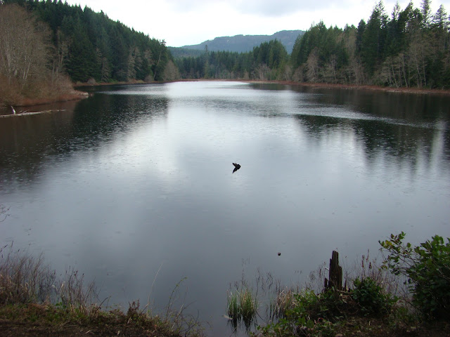
180 Degree Panoramic of Rhododendron Lake
 I fished for twenty minutes only today.  There were a couple of nibbles, but it looked pretty dead...  No rising fish at all.  A group of idiots on the other side were firing rounds across the lake and I decided they weren't bright enough to know anything about gun safety and so I left.  I passed several people arriving with beer cans in hand as I left which encouraged a further spurt of energy into my exit from the lake side.  But back at my bike, I met the king of the local redneck population!  (This is the gene-depleted man who needs the banjo as a warning sign to all who come in contact with him).  Perhaps I'm a greater fool for even attempting to communicate with him.  He told me that the power lines route was clear of snow now.  "Yuh, I jus' bin up there in ma truuck and she's cleeeear awl the way thru."  I took it hook, line and sinker.


The power line route from this end is extremely steep and rocky.  I was well past my comfort level going up this road and the thought occurred to me that it would be a good deal harder coming down it.  Good thing there's "no snow on the power line route."     

The climb from a distance
 I made it up in one piece, albeit a little sweatier than I was five minutes before.  That was a ridiculous climb on large chunks of rock and I'm not sure I ever want to try it again!  I sat at the top, recovered my senses for ten minutes and allowed some blood to flow back into my knuckles.

A small waterfall close to the top.  Nice resting point!


The trail settles down at the top and begins to wind it's way toward the spot where Paul and I got stopped by snow a couple of weeks ago.  I eventually met up with pretty deep snow at almost 700m and gave it my best shot, but it was pretty clear that I had to go back down that #@&!*% hill.  I was 2km from our recent "stopped at snow" location on the other side.

I made it through this one, but it was getting pretty obvious that I was not going much further.


The ride back down was abominable and I was clearly out of my league here.  I don't have the skill nor the agility to swing the rear end of my bike around to descend hills by fishtailing to cut the speed, and I'm not even sure it's possible to do so on rock chunks of this size.  I began an extremely slow and gradual descent by using both brakes to literally inch my way down.  At times it was nearly impossible for me to use the rear brake at all and a controlled skid from the front was all I had.  Thanks Banjo Boy!  What a relief it was to return to slopes where I felt in control.  This was a good eye opener for me.

I returned along the same route through Okay Mountain's back valley and followed the power lines to the same roads I rode on the way out.

I didn't notice these large "inukshuk" style rock pilings the last time Paul and I took this road.  I don't know who did it...  Perhaps the logging company piled the rocks up while building the road.  Formed by erosion?   Naah. 

Dog Turd Shaped Inukshuk
         

That's it.  Great ride.  I'm completely worn out.     

Here's a Google Earth overview of the route to the lake from Doumont:


Friday, April 27, 2012

Kidney Lake Bonanza!

Took a nice ride out to Kidney Lake after work today.  When I arrived the lake was calm and full of rising fish.  I couldn't get the line in the water fast enough.  Caught a trout on my third cast!  Five in all today, six if you include the one Paul caught when he showed up late and stole my spot.


Tried bait fishing for a short spell, but no dice.  They were going for gold spinners today.


Wee bit o' rain, but generally pretty dry.  Great day at the lake.


Friday, April 20, 2012

Friday Workday... then FISHING! ڷ

I zoomed out of work really quickly today so that I could get a few hours of fishing in at our local lakes and by 4:00 I had a line in the water at Kidney Lake.

It was a great ride down there:  1Km before the lake I heard a thunderous clatter to my left and made a mad scramble for a camera as a herd of 8 to 10 elk crossed the road right in front of me.  They were pretty spooked by my bike and so they moved really quickly to conceal themselves in the trees to my right.  I managed to get one shot off with my Garmin which was close at hand, but got nothing of the herd.  So, off I went with my heart pumping about twice its normal rate only to meet a single female still looking for the herd.  She gave me a bit more time and loped well ahead of my position so she could cross over to the other side.  I captured her with the Garmin...  Not a quality shot, but at least I got it!  Totally thrilling watching them motor by like that!

Purple route from "Intersection A" (bottom right) to NE end of Kidney Lake.

Get out your magnifying glass!  She's that clump of pixels near the centre!
 
So, I got down to the lake and fished with some bait for a change.  I set up "Andy's Handy Dandy Lake Trout Rig" which consists of an egg sinker (1/8lb lead weight that slides freely on the line), a swivel clip (which doubles as a stopper to keep the weight on) and an 18" leader attached to the swivel for floating bait.  For bait I used yellow and orange scented Glo Mallows.


The beauty of this rig is that it allows the line to slide freely through the weight.  That means that when the trout hits, it travels away with the line unimpeded by the weight and sets the hook when the slack is taken up.  It's perfect for stocked trout that have a tendency to hit aggressively in this way.  A small treble hook can be used also, providing it's small enough to be lifted by the bait (#14).  Great for molding bait around with Power Bait.  Also, leader length can be changed to match the weed height in any particular lake to keep the bait floating right at typical feeding height, (slightly above the weeds), for bottom swimming trout.

I fished that setup for about two hours without so much as a nibble today.  There was lots of action on the surface by 6:00 and so I switched to spin casting my "Super Duper" favourite spinner.  I caught the youngest and smallest trout in the lake with this.  IT WAS DELICIOUS!!

YUM

Tuesday, April 17, 2012

Powerline Route to Rhododendron Lake

Took off with Paul last weekend to take a look at the disused gold mine on Mt. DeCosmos.  There's still plenty of snow on the summit, but the mine is at pretty low altitude and we figured it would be easily reachable.  We took the lower Blackjack Ridge logging road to Nanaimo Lakes Road and continued west towards the mine turn off.  Surprise--the large gate was locked and blocked our entry towards Second Lake.  (I knew there must be a reason $2 Hitler wasn't in his bunker as we entered the lakes area).  I wish they'd at least put a sign up to let you know the area is locked-up before you motor all the way to the gate!

Anyway... a freshly concocted plan #2 seemed like a worthwhile venture:  We decided to try getting beyond the deep pools on the power line route that leads from Blackjack Ridge to Rhododendron Lake.

The powerline route (yellow line from right to left).  Elevation profile (l to r) represents the yellow line.
 
I tried to get through this road earlier but the pools of water were very deep back in December and many large problematic rocks were too difficult to see.  It was much lower now and quite a bit easier to get through.  The route stays mainly within the confines of the power line clearing and only leaves occasionally as the terrain demands.  We crossed a few bridges, one of which had a really great river winding beneath.


Further on we came to a grinding stop when we discovered that the snow isn't quite done yet at 580m.  We got off our bikes and walked on for a short distance just to confirm that there was little point in continuing and then made our way back along the same route.  Here's a panoramic photo taken from a service clearing along the power lines.  (View full size for the panoramic effect).

Two-thirds of the way back along the power lines, we crossed a newer logging road and decided to follow it.  It was well worth it!  It turned out to be a great trail, (cyan line), that lead back to the intersection that begins Blackjack Ridge's lower road.  (I'm calling this "Intersection D" since I've slowly been creeping south with my intersection names, busily renaming everything I find as any good flag planting Brit should).


    So that was it.  Finished off with a bit of fishing at Boomerang Lake as a matter of course.  It was a really good ride and I'm looking forward to doing the entire power line road in a month or so when the snow has gone completely.

Monday, April 09, 2012

Didn't Get the Jump on Jump Lake!

Had a terrific ride with Paul on Saturday.  We headed out to see if we could get to Jump Lake, one of Nanaimo's watershed lakes.  The route looked plain enough; through the traps, follow the logging road that runs the base of Blackjack Ridge, a short spell on Nanaimo Lakes Road and then follow a short route in behind (south of) Gemini and Green Mountains.  It was good in theory... then we ran into the locked "Nanaimo Water Shed District" gate shortly after we crossed the Nanaimo River.

The locked gate at Nanaimo's Watershed District.  Paul's trying out his new helmet, goggles and a fancy Swann digital movie camera.  Nice gear!
 
Looking east from the bridge crossing the Nanaimo River.  There were a couple of guys panning for gold off the other side. 

What now?  We were well on our way to the Nanaimo Lakes and we both had our fishing gear, so off we went to Fourth Lake to try our luck.  We were stopped at the entry gate by some little man masquerading as Hitler who demanded $2 entry to the lakes!  Didn't get that the last time we went through.  Just lucky the last time I guess since Hitler maintained that people always pay at the gate.

The ride to Fourth Lake was great.  Lots of dust out there already.  It was really interesting to have a quick look at the entry road to the gold mine on Mt. DeCosmos, an upcoming summer ride.  That's a big mountain as far as local mountains go and it looks quite intimidating from the Nanaimo Lakes Rd. side of the mountain.  The logging road that leads to the summit skirts around its edge and climbs up a much milder looking NW side.  

We hit snow at the final turn off that leads to Fourth Lake so we parked a short distance from the dam and walked up the rear slope.  Terrific day for fishing.  Beautifully clear up there; a bit breezy but comfortable sitting on the dam catching its radiant heat.

Panoramic (180 degree) down the length of the dam
 
The lake's water level was much higher than it was during our earlier visit in the fall.

 We didn't catch anything here and decided to continue with our ride with a stop off at Boomerang Lake to see if we might get something.

Boomerang Lake 

I fished at the usual spot directly forward of the trail that leads in and Paul fished off to the right.  I got skunked and Paul caught two small trout. 

I packed my Garmin's battery housing with memory foam for this ride.  It worked well and I didn't see anything of the bothersome cutting-out and rebooting that had driven me close to insanity on my previous two rides.  I was pretty pleased that the unit had stayed on for the entire trip while recording the entire ride.  That's going to work better in the bush!

Great ride!  It's really nice to get back out there with Paul after the winter hiatus.

Friday, April 06, 2012

Another Attempt at Okay Mt.

I had another go at getting up Okay Mountain today.  This time I decided to try another route since Paul recently met the same nasty pile of snow that I ran into a few days ago.  (He claims to have moved my difficult log, but I prefer to believe that the melting snow caused it to drift off the trail by itself).  Instead of using the "around Okay Lake" route, I turned right at Branch 142, (the Boomerang Lake turning), and headed to the Okay Mountain road from the northern end.  Success, but what a hairy road!  The steep sections are quite rocky and in this wet weather they pushed my riding skills to the limit.  I found myself going much faster than I really wanted to go just to prevent the back wheel from spinning and digging into the wet and loose road base.  (Actually, it was more of a creek bed at this point than it was a road).  Very steep, unstable and slippery, and close to the limit for my riding skills!  Eventually, I was stopped by snow anyway!


I think when the road dries up it will be a terrific ride; still difficult, but very do-able.  I turned and went back down with a satisfied feeling of having come that far.  Google Earth shows a steeper section towards the top of the mountain.  Might be a harder climb than I had envisioned.  It was a pretty slow descent in some sections on the way down!  I reached the Okay Mountain turnoff, took a panoramic photo facing the coast and turned right to see if there was any snow on the familiar road that circles Okay Lake.

Panoramic view towards the coast taken from the beginning of the Okay Mountain logging road.  Sadly, this isn't the heaviest logged section along this route.  There's a strong smell of freshly cut cedar in the air around here.

About half way along the route I decided to turn left on a well-marked logging road to see if it would take me back to Branch 142, (the road I had taken to get out here).  The quality of the road was pretty good and I think it would have taken me all the way back to 142 had I not been stopped by my GPS!

Once again this top-of-the-line Garmin product had taken me into unknown territory only to switch itself off repeatedly.  I refused to go further without knowing where I was and backtracked my route by memory, (which is very chancy for me I can assure you).  Too bad because I'm pretty sure I would have made it after looking at Google Earth when I got home.  I was steaming mad at Garmin who have taken a sizable bite out of my wallet to get me lost like that!

I googled "Garmin Montana shuts off" when I got home and discovered that the problem may be a poorly fitting battery and loose housing.  The battery moves when jolted over bumpy terrain and periodically loses battery contact.  I've addressed that and now I'm ready to give it another try.  I came really close to returning it to the store today!             

Their advertising says: "Built rugged, waterproof and tough. Includes routable maps, supports 24K TOPO maps. Paired with an ATV mount, is ideal for hunting and off-roading. There's nowhere Montana won't take you."   What a laugh; one bumpy road and the unit quits.  I guess the designers are not familiar with the real conditions when off-roading.  I'm not impressed!

I shut it off after the tenth automatic reboot and retraced my route back through the tank traps to civilization.  Aside from the Garmin annoyance it was a really good ride!

This elevation profile covers the whole ride from the tank traps to the unknown route leading back towards Branch 142, (where I shut the GPS off).  The orange trail travels from right to left and the elevation chart reads from left to right.